Race 1 - Day 29
Crew Diary - Race 1 Day 29: Liverpool to Punta del Este
18 September


Where the heck are we?
Team Dare To Lead has been at sea now for over four weeks and a frequent question asked is “Where are we?”. Historically, a common enough marine question indeed, since ship captains (and their navigators!) over the centuries have always had the challenge of “Excuse me chaps, but where on earth ARE we?”.
I have just checked the CV25 TimeZero nav computer, and I know EXACTLY our location ...we are currently at S29deg 36.805 W042deg 05.914
However, this detailed information isn't hugely helpful in knowing where we physically are on the globe in human terms we can understand. Modern GPS navigation has revolutionised the maritime world, telling us the answer to our question (refer above – Ed.) to within a few metres. In the past, sailing ships used the sextant and (even earlier) the backstaff to get a rough position within several tens of sea miles (if they were particularly skilled and/or lucky). Sometimes they could only calculate a very VERY approximate latitude. The old sailing directions from England to the West Indies advised “Head south until the butter melts, then turn right. Keep going until you reach land”. Not quite to GPS standard, eh chaps?
Anyway, back to my exact position (above). Looking from the cockpit today, all I can see is ocean (no trace of land at all). From the deck of CV25, I can see about 10nM nautical miles. This means that I have direct line of sight of circa 300 square nM of salt water. Brilliant, but unhelpful ...this is the same amount of waves / water that I could see when we were in the Irish Sea, so I still don't have a clue where we are. We appear to be dragging sea around with us.
However, when I plot my position (S29deg 36.805 W042deg 05.914) on a chart (a sort of maritime AA roadmap for sailors) all becomes clear. I am currently, in fact, 335nM from the coast of Brazil, just off the Rio Grande Rise. Rio de Janeiro is 400nM in a roughly westerly direction from here, and if I look carefully from the cockpit I can just about see the beach umbrellas on Copacabana Beach (very small, of course – Ed.).
This, then, is my blog message to all aspiring Clipper Race sailors: by all means take your onboard GPS (and your plastic practice sextant for old time’s sake ...or even a backstaff if you wish to create a 15th century feel to your voyage). But DO NOT FORGET to put up a small paper wall chart of the world in the galley and mark up your daily position with a small red cross. In that way, you will always know the real answer to the question 'Where in the world are we’? Oh yes, and traditionalists must be sure to take along a pack of butter...
Contributed by Neil Harvey
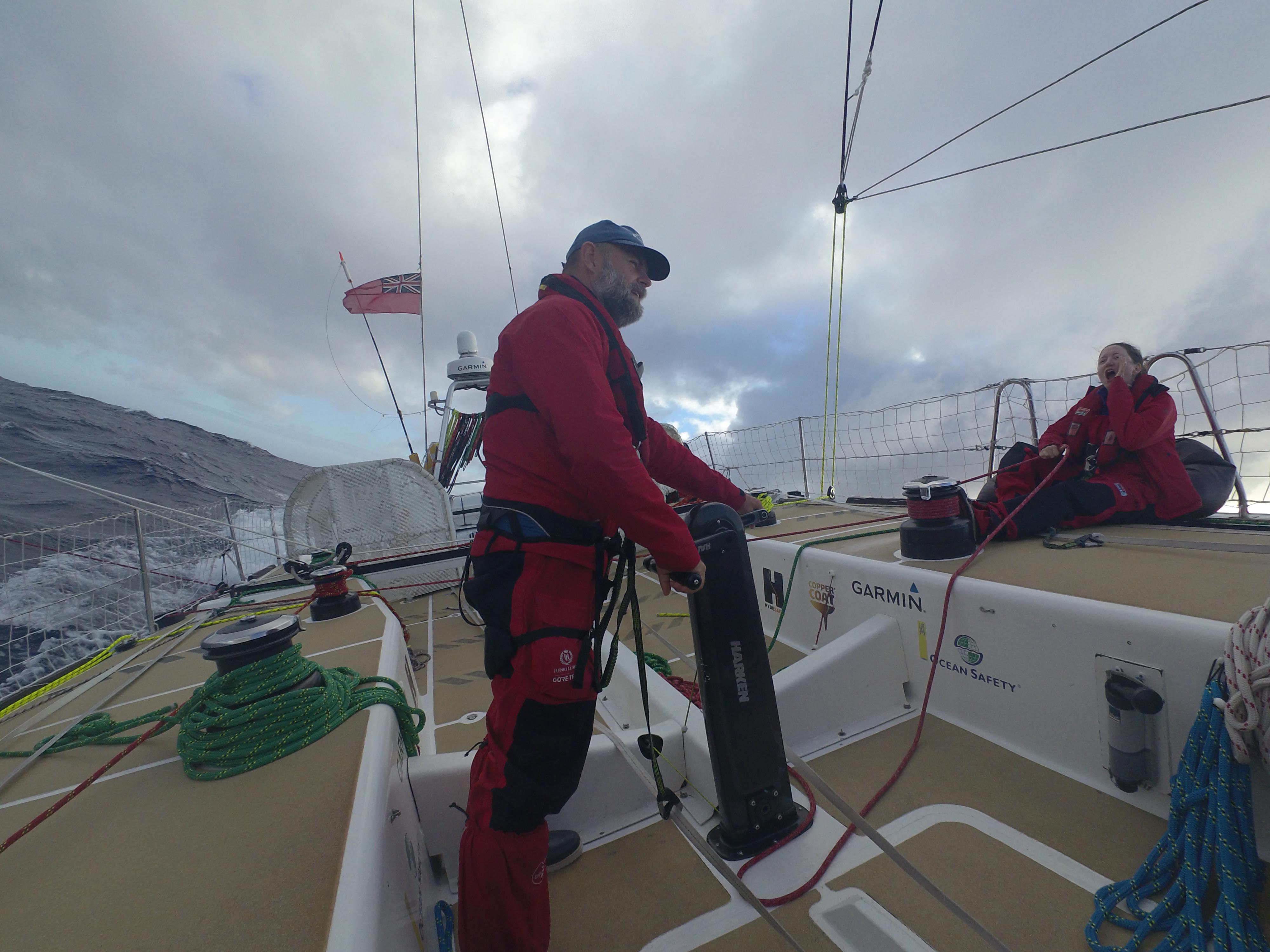
IMAGE: Trimming the spinnaker on Dare To Lead